Showing posts with label hiking Washington. Show all posts

Friday, November 20, 2020

Kendall Katwalk 11-09-2020

Knowing that there was snow on the PCT in the passes, but that it was not deep enough to cause a navigation issue or avalanche danger, and also seeing that a snowstorm would be coming through later that day to close the high country out for me, I decided to hike the Kendall Katwalk on my day off.

When I arrived at the parking lot, my car was the only one, and for the rest of the day I would only see 4 other hikers on the trail.  I love my solitude in the wilderness, so this was a real treat.  What a winter paradise it was!  Even at the parking lot there was ice on the puddles, and the higher I hiked, the more snow appeared.  Up along the ridgelines the trees were all flocked and my feet crunched over snow and ice.  I actually broke my yaktracks on this hike, due to the constant changes between snow, ice, and rock.


I knew that pikas didn't really hibernate, but was surprised to find them awake and super active, "meeting" out their warning call across the snowy rocks.

Once up at the Katwalk, I munched on some rapidly hardening food and watched as mist and snow clouds started rolling in, quickly covering up the nearby peaks.    


Apple Watch stats:  12.65 miles roundtrip, 3014 ft of elevation gain.

I have moved toward more videography, so for the whole adventure please check out my hike on YouTube at Kendall Katwalk Nov 2020, and subscribe if you enjoy it.  

Thursday, August 8, 2019

Day 4-5 Section J of the PCT 8/4-8/6 2019


Day 4 was going to be almost entirely climbing.  First a winding climb up and up through huckleberry filled forests and brushy slopes, and then after 7 miles of that, another nearly three up 1200 feet of switchbacks.  The day started out promising, with me spotting a bear about 100 ft off the trail eating huckleberries - he saw us and ran into the bushes as quick as I could call, "Bear!"  So Bradley didn't get to spot him, but we both saw and heard his crashing path through the bushes as he ran away.  I felt kind of bad interrupting his peaceful breakfast like that.

As the heat of the day kept steadily climbing and we kept steadily climbing, I started feeling worse and worse. I could live with the various pains, but I was overheating, feeling constricted, and having trouble catching my breath.  The stretches I could push myself were getting shorter and shorter.  I felt bad because Bradley was worried about me and to be honest so was I.  You have to know your limits.  I reached a point when I knew I would not be able to push that last 1200 foot climb up Cathedral Pass where we were planning on camping with the day as hot as it was.  I suggested we only finish hiking to Deep Lake and call it a day early, hike up Cathedral Pass early the next day while it was still cool, and then take the exit trail from Cathedral Pass and end our backpacking trip two days early.


Despite being a bit sorry I didn't finish this section, this was the best decision - we ended up having a wonderful camping day by Deep Lake.  Such a nice change to soak our feet in the lake and watch fish jump, watch the changing light over Cathedral Rock and laugh and talk and enjoy where we were.  We found our happy again and limped around the camp area with smiles back on our faces.


Day 5 we got up and hit the trail by 6:15am.  We made great time and got to Cathedral Pass without a hitch before the day heated up.  Cutting off the PCT on to the Cathedral Pass trail was rough.  We had been spoiled by the nicely graded switchbacks.  The Cathedral Pass trail descends 2200 feet into the Cle Elum River Valley and a lot of the descents are just straight slopes down without switchbacks.  To make it worse, they are very churned up by horse hooves, so it's dusty with a lot of loose rocks.  We slipped, slid, and stumbled quite a bit until we got into the forest and the trail was more firm and reasonably graded.

The forest itself was beautiful.  A lot of little ponds and creeks with frogs which refused to hold still for a good picture.  Also there were some beautiful cedar stands and huge Douglas fir.


We were both a bit worried about hitching a ride from the trailhead into either Roslyn or Cle Elum.  I pretty much told Bradley not to ever hitchhike all the years I raised him, and now I was telling him it would be just fine.  haha  Also it was a week day so we weren't sure how many people would even be there.  It is not an area I'm familiar with at all.

As luck would have it, we met two of the nicest characters you could imagine.  Two brothers in their 70's, one retired Forest Service, who had had to end their backpacking trek 2 days early as well because the younger one had thrown out his back.  They were heading into Cle Elum anyway, and were happy to give us a ride.  They didn't seem to want any money for their troubles so I bought us all lunch when we got into town as a thank you since non-rehydrated food was high on the list of things we were all looking forward to.  It cracked me up and inspired me to no end that the older brother brought in a stack of backpacking books and maps to the cafe so they could plan out their next adventure.

Not long after they each went their separate ways, my own personal hero, Dave, arrived to take us home.

Lessons:  I learned a lot from this adventure!

  • Make sure you are striking the right balance for yourself between challenge and enjoyment.
  • I had hiked quite a few trails the length I was planning on doing for this hike, but not consecutively.  Discomforts from one day compound in multiple days - aspects of this lesson include trail length, average temperature (I usually hike cool cloudy days), pack weight, and gear.  Each will feel different in 5 long days as opposed to 1.
  • Don't just do training hikes on other trails.  If you can, do day hikes into sections of the trail you're actually going to backpack to get an idea of water source and terrain.
  • I thought I had done a good job of lightening my gear/pack, but I definitely could think of things I could have cut out, and weight really is going to make a difference.
  • Don't assume there will always be water where there is usually water.
  • Talk to people on the trail when you get a chance!  Lots of really great people out there and we learned a lot about the trails intersecting the PCT, water sources, and gear choices from others.
  • If you're doing a long stretch, don't just look at the map of the trail, but also the surrounding area and have some exit strategies planned.  The gentlemen that gave us a ride and ourselves were not the only ones that exited where we did. Another hiking group we talked to had lost one of their number to a knee injury the day before and she had exited the trail at the same spot.


Thoughts:

  • There are still a lot of really good people out there.  Whether it's as big of a blessing as giving you a ride when you need one, to just sharing the view with you and sharing trivia about the peaks you're seeing, the people on this trail were a pleasure.
  • It's amazing the simple things we take for granted.  As I washed my hands at the cafe with water just rushing out of the faucet I reflected on how cautiously I poured water from my container on the trail to not waste one precious filtered drop.
  • Whether the lessons and realizations you come to on the trail are good or bad, adjust to those things and get back out there!  Our world is a staggeringly beautiful place!


When I'm in my 70's I hope to find myself wrapping up one hike or backpacking trip and already planning my next!
Happy Adventuring!

Day 1-3 Section J of the PCT, WA 8/2-8/4 2019

My oldest son suggested a backpacking adventure for after he took his Bar exam, so we'd been planning one for about 9 months.  Our original plan was the Wonderland Trail which circumnavigates Mt Rainier, but that is on a lottery for the most part, and we didn't get drawn.  Our plan B was Section J of the Pacific Crest Trail which has been on my bucket list for quite awhile.  It is the stretch of the PCT between Snoqualmie and Stevens Passes, and we planned to do it northbound taking 7 days and averaging about 11 miles a day.  We ended up doing about 54 of the planned 75 miles and ascended a cumulative total of over 11,000 ft in 5 days.

Day 1, we weighed our packs in at 36 and 38 lbs, and my husband drove us up to Snoqualmie Pass in the morning so we could get a nice early start.  It was a misty, cloudy day, and a perfect temperature to hoist our backpacks onto our backs and head up the trail.


This stretch wound through the woods at a gradual climb up to end up hiking along a ridge, still gradually climbing, winding past Red Mountain and to Kendall Katwalk.  I have hiked to the Katwalk quite a few times and love this part.


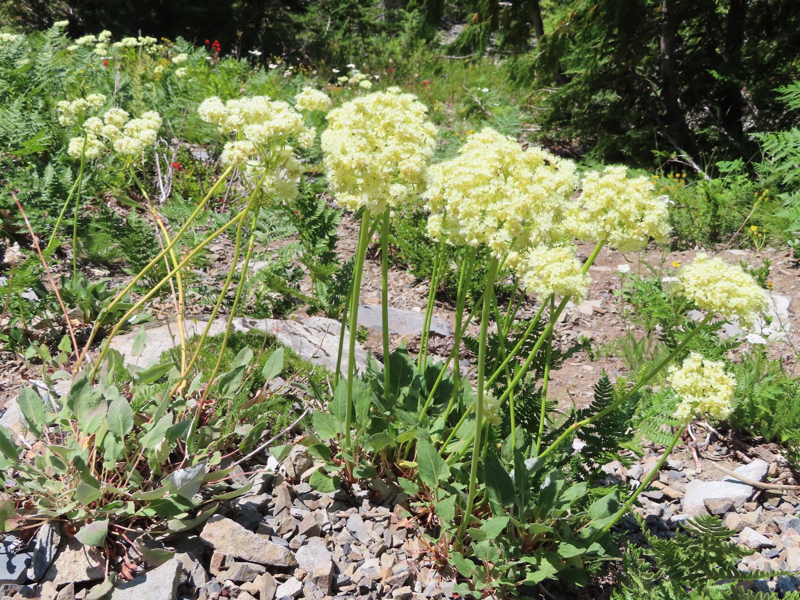
We saw quite a few marmots and pikas, a profusion of wildflowers, and beautiful teal blue alpine lakes far below the ridge we were staying on.  This day I saw the only deer of the trip, and it was across a valley on a neighboring slope of wildflowers.


We camped that night at Joe Lake.  Usually there is a water source near the campsites marked on the map, but this time the lake was at an inaccessible 400 ft below the ridge we were camped on.  The pools that we could see might normally be there this time of year were dry, and we had to filter water from what was left of one.  Amazing what a filter can do.
 

We were a bit sore, but expected that, and turned in for the night in good spirits.

Day 2 carried us up onto Chikamin Ridge and around the crest to stun with views of Parkland Lakes, the large Spectacle Lake, and a beautiful waterfall.


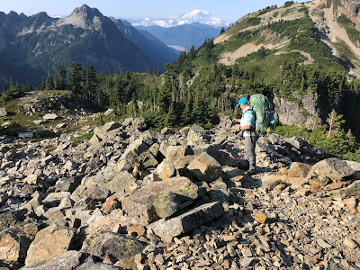
Most of the day was in the sun, which had warmed considerably, and there were long stretches of loose rock.  The last part of the day was a seemingly never-ending descent through an old burn.  It was beautiful with fireweed and some other wildflowers blooming among the stark charred white tree trunks.  It was also hot and the descent confirmed our suspicion that while our broken-in hiking boots and tested socks with liners had passed our long day hike tests, they were not working well for this longer trek.  Ouch!

We also had learned a lesson with water, having camped with a less than ideal water source that first night, and not passing much accessible water the first half of the 2nd day.  After that we stayed much more alert to how much water we had, how much we would need, and made sure we got it when we could.

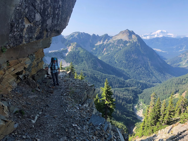
There was a pass (I think this was the 2nd day) from which we could see Mt Baker to the north and Mt Rainier to the south.   Beautiful!


We met a lot of nice people on the trail throughout - section hikers, day hikers and several through hikers heading southbound from Canada to Mexico.  Almost everyone was eager to stop and say hi, find out about where each other were heading from and to, where they might find water in the direction they were going, good campsites, bug conditions, etc.  We camped that night at Lemah Meadow.  There was a river running through and we totally scored with some makeshift benches in the campsite we found.


Day 3 found us hiking along nicely graded, long switchbacks up through the woods, then the subalpine, and then along the Escondido Ridge.  The views were sublime, and we saw more pikas, marmots, ground squirrels and chipmunks.  The wildflowers varied depending on the ecosystem and elevation we were walking through and it was just beautiful.  We also talked about the possibility of ending our section early - both our feet were looking pretty bad.  Blisters were not as much of a problem for me, but my pinky toenails were both purple and the sides of my big toes were a combination of pain and numbness.


This was the longest day, switchbacking the 2nd half of the day down off of Escondido Ridge and into the Waptus River valley for a total of just under 14 miles.  We camped near the Waptus River, and we were both more interested in getting into our tents than we were in eating dinner to replace the calories we'd burned.  We did a good job of encouraging each other to make sure no one missed meals and stayed hydrated though.  Two more separate hikers moved into the space adjoining ours at different points as we were zipping in for the night and they broke firewood and chatted loudly into the darkness.  Their headlamps kept lighting up the tents so finally Bradley asked them to please quit strobe-lighting his tent and keep it down a little.


We had agreed that Day 3 we could pick trail names for each other and we were both allowed one veto.  My trailname is Waterstop, as I used getting a sip of water as a nice reason to pause my sore feet on the trail, and also I was always nervous about finding water sources where we would need them.  Bradley is Storytime because he kept me entertained with stories of his classes, things he learned, the book he was reading, and even fables he made up on the spot.

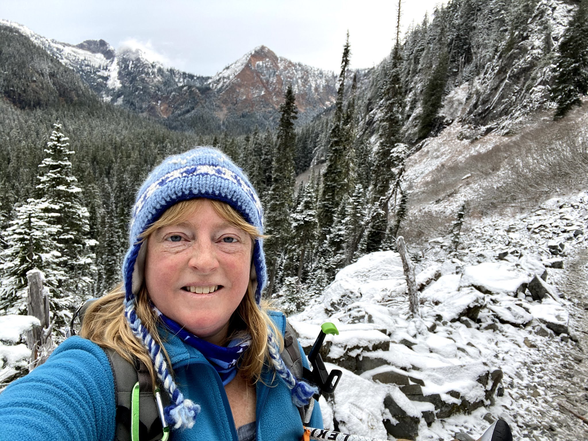
Credit to Bradley for almost all the pics of me and the two of us together!  : )