Monday, August 12, 2013

Kendall Katwalk 8-10-13

Today was supposed to be a Camp Muir climb, but I want to have a near-guarantee of a view when I do Muir, and very few of the people who expressed interest in joining in were able to make it.  So instead, with a forecast of partly cloudy with chances of thunderstorms, Dave and I decided to hike to Kendall Katwalk, with Cedar as our faithful escort of course.
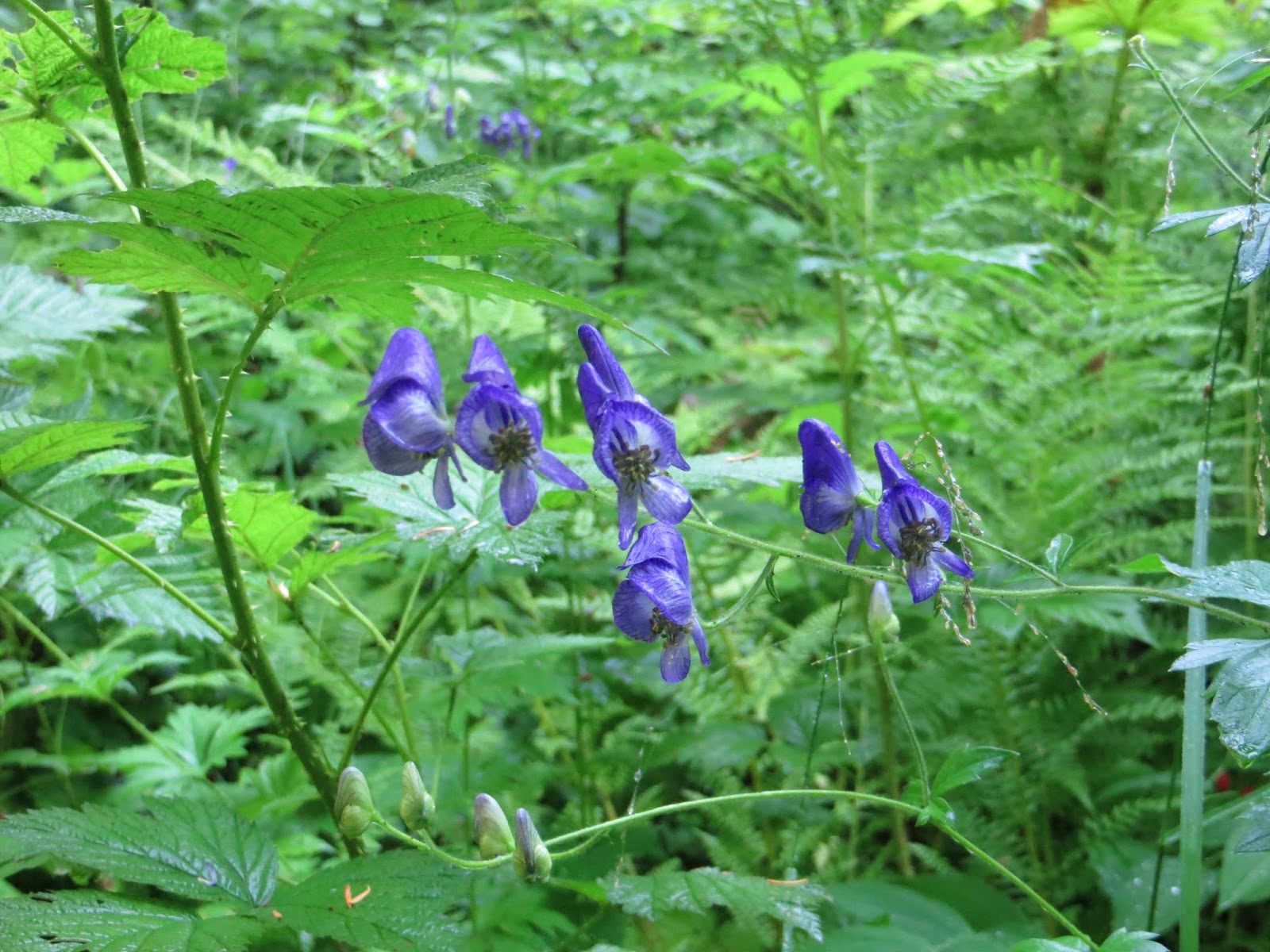
The wildflower season was wrapping up, but there were these pretty blue flowers here and there, as well as the last of the Indian paintbrush and lupine further up.  This may be monkshood?  I can't find my wildflower ID book. 
 
I think this is Lonely Mountain.  If we have more time, maybe we'll stop in and see if the dwarves are home when we are in the area again.  ; )
 
 Here is an eye test for you.  Examine the rocks below.  Do you spot the pika? 
 
 Don't feel bad... I'll zoom in for you.  There he is!


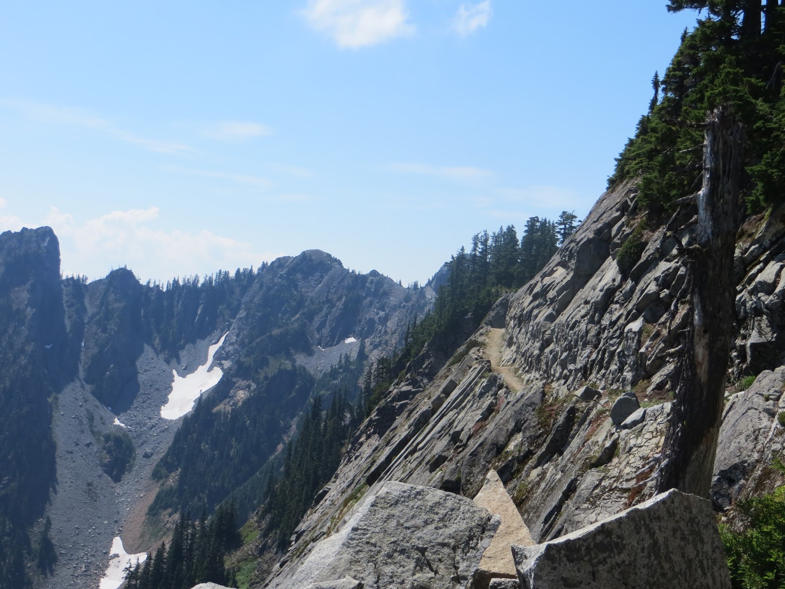
This 11 mile roundtrip trail gains over 2500 feet of elevation, so it's best to start in the morning.  A lot of it is under trees, but there are large stretches that go over rockslide areas, and those can really bake you when the sun is on them. 

Here is a view of Red Mountain.  If you're color-blind you probably can't tell why it's called that.

I didn't remember so many streams cutting the path, and most are in the 1st half of the hike, but there are quite a few cheerful little rivulets and waterfalls.

A wildflower that was blooming in profusion was the fireweed.  Cedar was happy to take this little break amongst the flowers.


I think the partly cloudy day made this hike even better.  The surrounding mountains and hills appeared even more dramatic rising above the misty clouds.

Here is another eye test for you.  Can you find the marmot in the photo below?  This shy fuzzy guy looked on the small side, so we guessed he was this year's marmotlet.  Next year no doubt he'll be fat and sassy.
 
 Here is another view of Red Mountain.  It is quite striking anyway, but even more so because the mountain that it connects with to the west is ash gray.

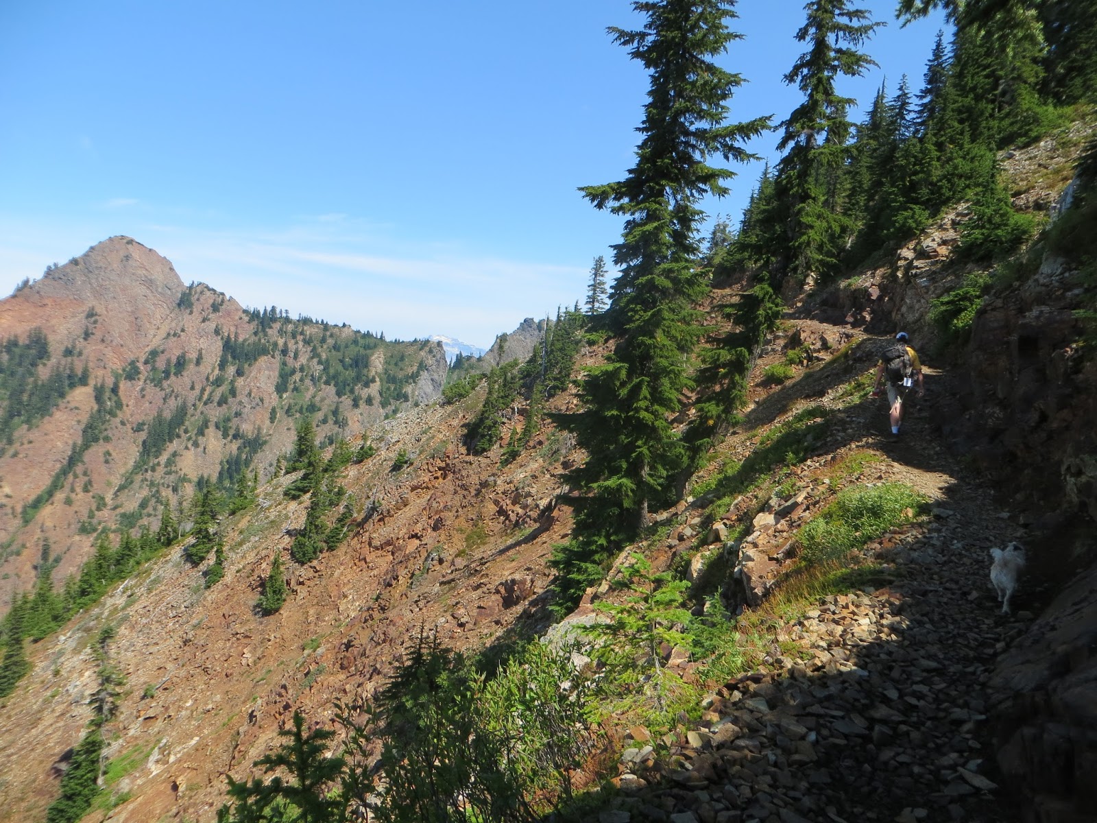
Here Dave and Cedar toil up the trail with Red Mountain in the background.

In the middle of one of the rockslide areas, some animals-possibly marmots (although I thought only the Olympic marmot whistled) or pikas (although I've never heard them say anything but "meeeep") started whistling shrilly and sounded distressed.  I looked up and saw movement, "Is that a marmot?" I asked Dave dubiously.  He looked up the steep rocky slope also, "It's a bird of prey!"  Then I saw that the thing was flying up into the air and then hurtling back down over and over.  "Yes, I agreed," and watched to see if it would catch a marmot or something.  About then we both realized the flying, diving, animate object was really an INanimate object and both of us shouted "ROCK!!!! ROCK!!!!"  It was fairly obvious it would miss us, but was heading right for the man and his Australian shepherd behind us.  He called his dog back and the boulder (a bit bigger than a basketball) came crashing down onto the trail between us and him, and careened off the other side, a violent victim of gravity.  We had kept most of our attention upslope to make sure no other rocks were coming down, and still the shrill whistling sounded.  I thought about it later... even the wild animals are at risk from falling rocks and landslides.  Whatever animal sounded the alarm, it was warning its friends and neighbors and just luckily the people on the trail were paying attention also.  It's a good thing to stay tuned with normal versus abnormal sounds, and the feel you get from the environment around you.  I think the more you are out in nature, the more you are able to hear when you listen.  Anyway.. it was a bit scary and definitely got my adrenaline going!!

Here Cedar models some small lakes below the trail. He is also modeling lines in his hair that show how his mom feels about paying for a professional groomer, heh heh. 
 
 Adventure Dog always loves the views.  He looks around frequently and takes more of an interest when there is a panorama or river or something breathtaking to see.  I would say he shows just as much, if not more, interest in the views along the trail as he does the wildlife.


 And at long last we reached Kendall Katwalk.  It was quite a popular hike this day, so it was difficult to get shots without a lot of other people in them.


 We crossed to the other side and ate our lunch with a view so lovely it would have brought tears to our eyes if we weren't so hungry by then.  After eating (picture Cookie Monster, having been made to march for miles, suddenly coming across a plate of double-chocolate chip cookies), we just soaked in the sunshine and the incredible vista before us.

 
It was an epic hike, and one that I thoroughly recommend.  Bring plenty of water, as you will exert yourself quite a bit, and plenty for any 4-legged companions as well. 
 
And now for some trail humor.  I have sure been seeing it a lot lately.  This amusing commentary was found in the privy (not that I condone graffiti)

 
And finally....Smoky?  What have they done to you?!?  : (

Monday, August 5, 2013

Mt Townsend 8-4-13

Second peak climb in two days!  Woo hoo!  This peak is so far the highest of the lower peaks I have hiked at 6280 feet.  The hike was steep and long, but not the steepest or longest I've done in the last few weeks.  This trail is 8.2 miles round trip and has an elevation gain of 2900 feet.  With the gorgeous warm weather we are having, it's definitely a workout.  My cousin Amy and her dog Stickeen joined Cedar and I for this one!
We saw a deer on the highway on our way to the trailhead, then a grouse and a rabbit as we got closer. The backroads are really nice to drive around Quilcene.  Right now they are lined with daisies, fireweed, the last of the sweetpeas, fox gloves in both purple and white, and a few straggling tiger lilies as well. 
We'll start out this journey with a smile.  Apparently people on the peninsula like sharing their humor and carry Sharpies when hiking (see salal leaf from last entry).

The lower part of this trail was through forest, but it wasn't long before we were up in the wildflower meadows with a beautiful panorama spread out around us as we hiked.


The wildflowers all along the trail were cheerful and beautiful.  My camera just didn't do them justice, but here are a few.


Once we achieved the saddle back top of the ridge, we could see the high point and had just a little climb further to get to it.  On this last leg we saw both a huge pair of ravens sitting up on the ridge and also a brave little chipmunk who kept bright eye on our canine companions.
 

There were little rock towers people had stacked at the highest point.


Up here we were took in the amazing views... you could see the Puget Sound from one side and glimpse the Straits of Juan de Fuca from the other.. we all took a much-needed break and ate lunch.


I would highly recommend this hike on a day with a view.  It is really impressive and breathtaking.  There is an awful lot of climbing involved if there wasn't a view though.  I wouldn't do this hike on a cloudy day.  The best day for it would be a clear cold day I think.  The heat was just too much for little Cedar.  He made it all the way to the top on his own power, but when we started down he burrowed into the lupine and absolutely refused to take another step.  Amy helped me rig a sling from a sarong I carry in my pack and I brought him down maybe a third of a mile or so that way.  Then he was OK to hike again and came out the rest of the way on all fours. 


Get out there and enjoy this amazing part of the world!

Mt Zion 8-3-13

It was a cloudy day so I wasn't expecting a view on my Mt Zion hike.  Cedar and I drove up into the hills, and the trees and rhododendrons were shrouded in mist.  The trail is called the Sleepy Hollow Trail, so this set the perfect mood.


This trail was 4.6 round trip and not too bad in elevation gain.  I met a few friendly hikers (who like me hoped the clouds would clear or we'd get above them and look down on the cloud bank) and it was a fun and pleasant hike except for people target practicing in the area.  Gunshots would ring out now and then and Cedar was extremely jumpy.  It definitely detracted from the hike.
We saw a few mushrooms and some interesting flowers of the non-chlorophyll sort.


This would be a gorgeous hike when the rhodies are blooming.. they were found along a lot of the trail and at the top as well.  There was fireweed blooming and although the tiger lily you can't quite make out in the background is past its prime, I enjoyed the humor someone leafed behind. haha


I believe this was the actual summit, although mostly blocked with trees.  I'm not sure how much you would see in between the trees since I saw mist and clouds in between. 

I did take the 1/2 mile hike along the ridge to the southeast to a rocky outcropping that hinted of stunning views if it wasn't sitting inside of a cloud. 


There used to be a fire lookout up here, and they got their water from a spring that is actually right up on top of this ridge.  There is nothing much but bolts in the rock from the fire lookout, but the spring is still springing along.

What a nice hike!  I'd like to do this again on a clear day.