Monday, May 27, 2019

Iron Goat Trail 05-28-19

AppleWatch Stats:  6.02 miles RT (went West along the lower grade, up to the higher grade and then down the switchbacks), 723 ft of elevation gain.

Last year I discovered that this ointment called "Green Goo" that I'd gotten from an outdoor company was a wonder at soothing wasp stings.  It needs reapplied every time the hurt comes back, but reduced pain and swelling.  Similarly, the green trails of the Pacific Northwest are the green goo that soothes when the heart and soul are stung by various things in life.  Again it needs reapplied often, but I am not going to complain about that!

This was a gorgeous sunny day to take a hike, and I headed up to Iron Goat with Cedar and Luna.  I felt kind of bad because Adventure Dog is getting older and he was a bit tired from the hike the day before and Luna just hates going in the car.  But my heart was in need of some green goo and it works better when my pups are along.  I picked this trail because of the length still being a decent length, but easy as far as elevation gain so I wouldn't push Cedar too hard.

The wildflowers were stupendous!  Wild strawberry, flowering currant, thimbleberry flowers, a lady slipper orchid, coral root, bleeding heart, Indian paintbrush, columbine, tall bluebells, and numerous other flowers I am not sure the name of.


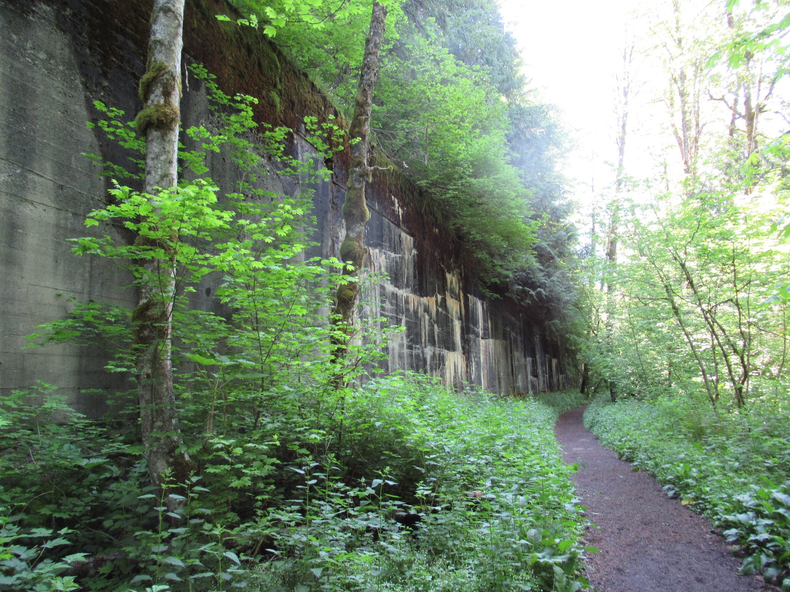
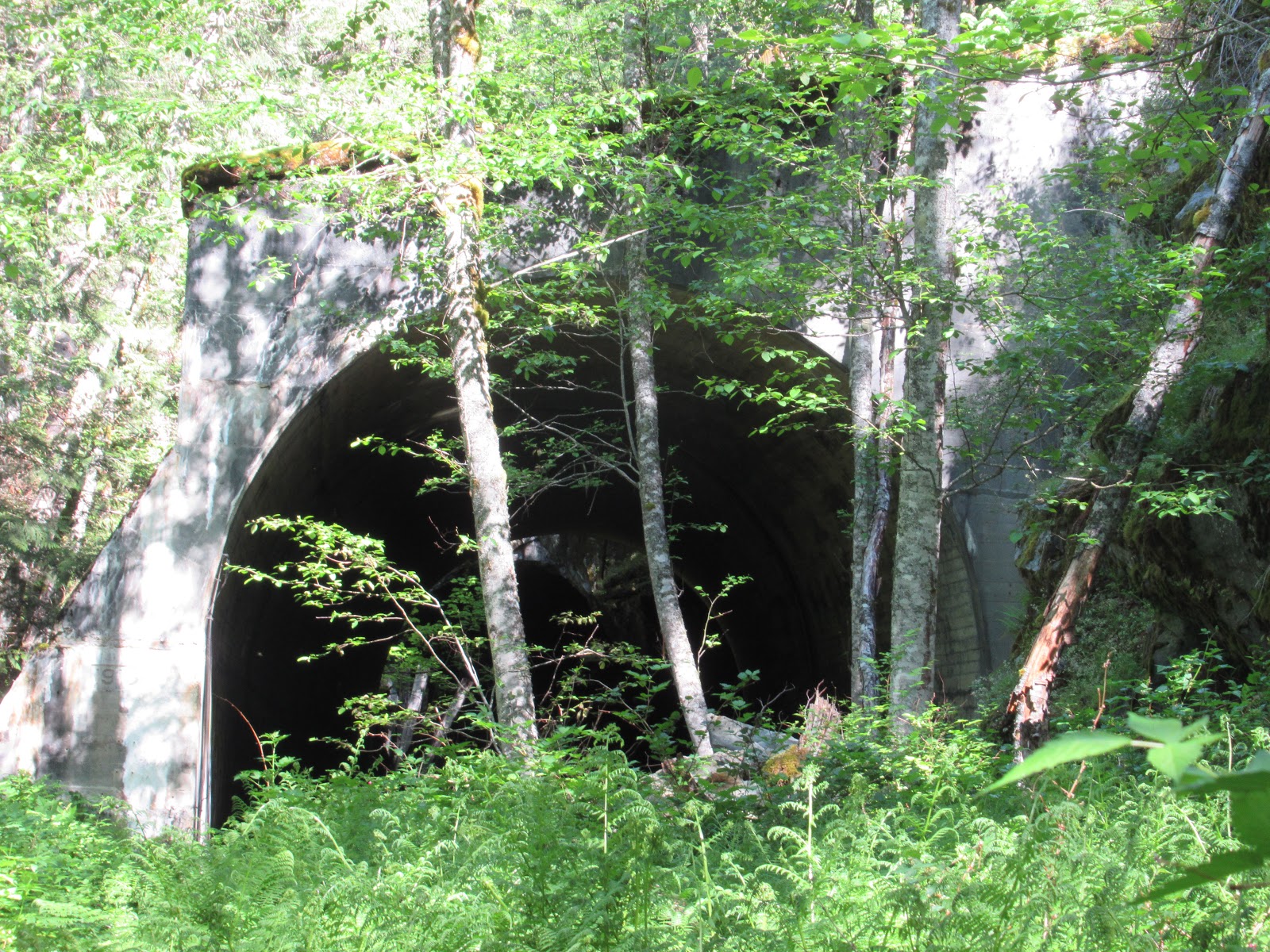
Of course one of the biggest draws with this trail is the railroad history.  This trail follows the lower and upper grades of an old railroad line, in fact the site of one of this country's biggest railway disasters.  There are many tunnels in varying degree of erosion and vast stretches of concrete wall that once supported snowsheds, the hope in vain was to protect the railroad.  I love these great walls, splashed with various colors of mineral, lichen and moss.  Numerous little waterfalls cascade over them and one even has a little stream flowing down a channel at the bottom.




From the upper grade there are some decent views of the surrounding peaks as well, and if you're lucky you might see a train across the valley on the active rail line.  I heard a couple going through (sadly you'll also hear Hwy 2 almost the whole time), but didn't catch one of the trains during a time I passed by an overlook.


Happy adventuring!
Forgot my cap and made do with a handkerchief, which I had never done before, so my hair ended up knotted in it lol

Sunday, May 26, 2019

Mount Zion 05-26-19

AppleWatch Stats:  5.38 miles RT, 1519 ft of elevation gain.

Luckily I had thrown my hiking gear from yesterday's sodden hike into my aunt's dryer so I was prepared for a hike today.  Cedar and Luna needed a leg stretcher too, so we went to Mount Zion.  Last time I did this one, it was just me and Cedar and it was very foggy so we had no view.  Today the sun had broken through and it looked like a great day to be on top of a hill.

The way up was lovely (other than the sound of gunshots from someone target practicing somewhere out on the forest service roads - we heard this the whole time, and I remember hearing it the whole time we last hiked here as well.  Bummer!)  We saw only a couple opening rhododendrons toward the start of the hike, but as we hiked up I saw quite a few of the beautiful lady slipper orchids, some coral root or indian ghost pipe just starting to show out of the ground, and flowering currants.


I think this is deer foot vanilla leaf.

The usual pink lady slipper plus a couple very pale colored ones.


It's a steady climb, but a nice grade up through the forest to the top where we were rewarded with a lovely peek-a-boo view of the puget sound.

We followed the ridge trail quite a ways to the right, passing a natural spring, and came out on a rock face escarpment with a gorgeous view of the surrounding peaks.


I think the only reason Luna looked at the view is because Cedar just did and she copies him haha
The dogs and I were happy to get out and enjoy the sunny day, and everyone else out there looked really happy too.
Here is a shot of some of the wild rhododendron along the forest service road on our way down.


Tubal Cain Mine 05-25-19

Trail Stats (Can't use AppleWatch because it died partway through haha):  7.2 miles RT, 1600 ft elevation gain

OK, this hike goes in the books as the wettest hike I've done to date.  My raincoat did its best, but it soaked through to dampen my fleece and shirt.  My pants were drenched right away, and continued to just soak in water as I went.  I had to ring out the cuffs of my fleece a couple times.  I thought my feet were dry, but I was mistaken - I just had good socks so they were warm though not dry.  As I type the contents of my backpack are hanging about drying or in the wash/dryer.  And yes, it had its rain cover on too.

This hike was not solo!  And though I don't mind some rain, I think it may have been miserable had I not had such great company.  I did this hike with my aunt, cousins and one of my cousin's daughters who did NOT whine the whole time.  I was duly impressed.  We laughed when we took a wrong turn and went miles out of our way on the way to the trailhead, we laughed in the rain and sniffed wild currants that smelled like watermelon, we laughed when we ate our snacks shivering under an overhang of a boulder and went up to the mine, and we laughed even harder when we coasted our vehicles down the 21 miles of back roads to the highway since we were nearly out of gas!

This is us at the very start of the hike after hiking in the rain for less than 2 minutes.  The better picture was taken by my cousin - my camera was already wet despite the neoprene case and most of my photos were foggy.


We were hoping to see blooming rhododendrons on the hike, but we were a bit early for them.  The blooming currant was lovely though and we were surprised to see our northwests' lovely lady slipper or calypso orchids.


There were streams and rivulets and burbling waterways everywhere, swollen and flowing fast with rainwater.  One little stream meandered through the moss and then would disappear under tree roots and such like little forest river tunnels.  It seemed like the setting for a storybook.


When we were nearly to the mine, I saw this log - doesn't it look like some kind of chopped wooden corpse with its stubby legs?  One arm raised as if saying "hhhheeellp meeeee."  OK, maybe the rain affected my sanity/mood a bit lol.

Before heading up to the mine we all had a snack under a huge boulder that had an overhang.  It was nice to have a break from the sound of rain pattering on my hood.

We ventured only just inside the mine, we were wet and cold and couldn't stay long.  In fact I had been planning on going up the hill that has the airplane wreckage on it, as I've never seen it, but with everyone so wet and cold it was best just to keep on moving out.


The misty, cloudy view from the top of the mine tailings was gorgeous.

We were all happy we'd done this hike despite the rain.  We were pretty well prepared and had a hot tub to look forward to when we got home.  We are looking forward to next time, although we are all hoping there is less precipitation!
Happy adventuring!

Sunday, May 5, 2019

Lake Serene 05-05-19

AppleWatch Stats:  8.84 miles RT, 2651 ft of elevation gain.

Well, I got in both distance and elevation with this classic hike off of Hwy 2.  I couldn't have asked for nicer weather - not too hot, but gloriously sunny.  I left Cedar and Luna at home as this would have been quite a push for them.  With the number of people on the trail, it's easier solo as well.  I was trying out these new socks by Injinji that came with sock liners that have individual toes to keep you from getting blisters in between.  I thought it might be annoying to have something between my toes, but they were quite comfortable, and I didn't get any blisters.  My stubby toes felt as comfy as swaddled babies. lol

Usually I skip the Bridal Veil Falls overlook, which is a 1/2 mile up stairs and incline, then back to the main trail, but this time I took that side trip.  It was worth it!  Also, like the WTA site says, do it on the way up.  No way will I ever want to add another mile by the time I get to that point on the way down.


The trail wanders through the sunny woods for the first couple miles, then it starts going up.  Quite a lot of the way up to the lake involves stairs - big wooden stairs, big rock stairs.  This hike is a great workout.


About halfway up, a man passed me from behind and said I was nearing switchback 9 - that there are 23 of them and then a 17 minute walk.  I had never counted these switchbacks, but around 13, I lost interest.  There are too many cool trees to look at, and I needed to move a little millipede off the trail so she wouldn't get flattened.

Then there were the views here and there of the valley below and the hills in the distance.


Plus more waterfalls, and streams to pick my way across.

And sooo many people!  I definitely want to do this hike in bad weather and/or start at 6am.  On the way down it's the worst because upcoming have the right of way and I had to step aside so many times, my Apple Watch thought my workout was over and kept pausing.

Once you come out of all those switchbacks at the top though, the sheer rock faces adorned with ice and snow just take your breath away and energize you all at once.

Once I made my way to the lake, I took a couple pictures of the lovely Lake Serene and then headed to lunch rock.  There I munched my PB&J sandwich and took some more photos.  There were a couple quiet little avalanches up in the crags. Just a slight rumble and then more snow and water would spew out over the precipice, giving extra volume to the waterfalls for a few moments before subsiding.


One good thing about having a lot of people on the trail - you can usually find someone to take a photo of you!  : )

The icy breeze coming off the water combined with the sunshine on the giant boulder to make the absolute perfect temperature.  I didn't want to leave.  I watched an ant carrying a butterfly wing for a bit and was entertained by the various snatches of conversation I heard around me.


On the way back down, I enjoyed the views again - of the Skykomish River below, the falls through the trees.  I also paid more attention to the wildflowers that were blooming - more trillium, bleeding hearts and violets, as well as this - mountain ash? The devil's clubs were just unfurling their spiny leaves, and the ferns' fiddleheads were starting to stretch up and become fronds.


I was surprised, as I passed under part of the large falls, to see two girls in long gauzy formal type dresses posing in the spray!  They had a bunch of people taking photos, so I didn't and just snapped one last one of the falls with the light making the spray shine like crystal.