Tuesday, December 28, 2010

Coal Creek Falls - Cougar Mt Wildland Park

Eager to try out my new camera on a trail (thanks, Mom!) and new water system (camel-back type, thanks Rosy and Chris!), but trapped in the lowlands by snow in the hills and by my late start on my last day off, I found this short hike off of I-90.  This is another nature area with many trails criss-crossing through, so you can choose your own adventure.  Cedar was eager to join me in burning off some Christmas calories, so we packed up and headed out.
We started out at the Red Town Trailhead, and went up that a short distance to the Cave Hole Trail.  This trail had warning signs that were worth paying attention to, because the area was full of coal mines which have since collapsed in areas where the ground softened, and on top of the fall hazard, some of them contain toxic gases. 

If there weren't warning signs, it would be hard to tell.  The banks are overgrown with sword fern and blackberries and the water that softened and collapse them, runs through their pockets and valleys, looking much like a small stream simply carved them on its own.
We veered off of Cave Hole Trail and went to the Coal Creek Falls.  They were not very flooded today, but still a bit brown from the recent rains, and definitely full.  I tried to get a picture of Adventure Dog in front, but he didn't want to participate very much.  I finally got this one, but he wasn't very happy about it.

We turned and retraced the trails, which were not overly muddy and quite wide.  Back at the trailhead, we had done just 2 1/2 miles, but I looked at a sign that said .2 mi to Ford Slope and looked it up on my map.  It said it was a coal mine exhibit and Cedar still had loads of energy after such a short jaunt. I had weighted my pack down pretty well to make up for the short length and nominal elevation gain, but jumped at the chance to add nearly half a mile more to our trek, so we headed off.

Look... moss really does grow on the north side of trees.  : )

Also, cool... some lichens remind me of coral. (Also nice check for the camera on close-ups... it did well!)
Just a hop skip and jump later through the quiet woods and we were at Ford Slope.  There was a cool coal cart on a tiny bit of track, and a cemented over mine shaft.  There was also a nice display sign with pictures from when the mining operation was going strong.  It was really interesting, as I had heard of the Coal Creek area before, but didn't realize that there had really been coal mines in the area. 
 
All in all, it was quite a fun little walk on a gray cold day.  I will probably go back and try more trails another time.

Sunday, December 19, 2010

Paradise Valley Conservation Area- Woodinville

I have to give a shout out to my friend, Tracy, who recommended today’s destination, Paradise Valley Conservation Area.  It was a gorgeous sunny day, following what felt like an eternity of rain and darkness, so I threw some things in my pack, grabbed Adventure Dog, and we were off.
This wonderful, close-in nature area features miles of trails meandering through acres of protected forest.  Some trails allow horses and mountain bikes, and there were flat logs with ramps here and there for mountain bikers to climb or balance on or whatever tricks it is they do.  One of the beauties of this place is that the trails are extremely well-marked.  A downside of this is that Tracy helpfully printed me out a color map and even though I had already looked at it and knew which branches I was going to take, I felt I had to look at my map every so often anyway with Bilbo Baggins’ voice echoing in my head, “Oh! I DO love maps!”  : )  The undergrowth was thick with salal, oregon grape, and sword ferns.
There were a lot of large trees down across the trails from the windstorm we had recently, firs, pine, hemlock.  It was sad to see them crashed to earth like that.  On the bright side a lot of the trail around them was blanketed festively with evergreen boughs.  I like to go over logs and Cedar likes to go under which involves a little planning ahead and juggling of the leash.  It was fun.
Not quite as fun was the other reminder of all the recent rain.  Mud.  Most of the time we could get around it pretty well, but we did get a bit muddy… Cedar because he’s so close to the ground, and me because I was trying to rush over an area of less-deep mud and Cedar stopped in front of me, which made me leap into the deep mud to avoid stomping him.

There were raindrops sparking on all the leaves and needles.  This one looked odd, because it was long pine needles caught in the branches of a different tree, and just hanging there. 
Sunlight cut through the canopy and spotlighted random tree branches, undergrowth or patches of mossy bark. 


There were a couple areas that the trees were so thick that it was dark to walk through.  Moss was heavy and green.  My camera, which continues to lie and say it’s out of batteries when it’s not, could not capture the green-ness, but tried.
In one spot I was amused to see that it looked like an elephant had been buried in the trail so that just the top of his head and trunk stuck out.  Don't worry.... I would not have been amused if it was a real elephant.   : )
We stopped for lunch and I had packed Cedar some roast chicken mixed with his dog food so that he would actually eat his food and leave mine alone (smoked salmon and Havarti sandwich- I so spoil me).  As we started eating, I heard an owl hooting from a nearby tree.  We surprisingly didn’t see very many people out walking despite the beautiful weather and it being a weekend.  There were several cars in the lot, so I think maybe it was just because there were so many tracks to choose from.
I had been thinking it didn’t seem so close to Christmas so warm and sunny, but noticed holly trees mixed in with the alders and evergreens.  So pretty.  What a lovely day.  If I read my map right, we did just 3.7 miles and it wasn’t difficult, but definitely pretty.   I will definitely come back and explore some of the other trails next time.

Wednesday, December 15, 2010

Quilcene Forest for a Special Tree

This was a different sort of adventure.. one filled with family and holiday tradition! 
It started out with my younger son, Justus, driving me to get in his required hours so he can get his license.  Giving up control of my wheels is a difficult thing for me, but he did fabulously...
Every year my relatives on the Peninsula go get their Forest Service tags and go out in search of their Christmas tree.  I usually opt to buy mine, but this year I had the opportunity to join them, so I jumped at the chance.  To get out there, we had to take a ferry and cross the Hood Canal Bridge.  These were both great opportunities for new driving experience.

We arrived the evening before the tree expedition and spent some time looking at my Mom and Aunt's new beach cabin!  It is so cute and cozy and I love the little beach.  It has oyster shells on it and is nice and pebbly, with rocks I flipped over to look at the tiny shore crabs underneath.  Fun!  Here is Justus and my Mom on her beach. 

The next day we joined up with my Aunt, Uncle, 2 cousins and one of their families, and friends and piled into three 4-wheel drive pick ups.  The forest service roads above Quilcene were still snowy and in some places impassable, even for our vehicles.

In places where there was more snow, we actually got to do a little sledding.  Cedar wasn't too thrilled with it all... the snow was not only cold, but melty and wet. 


Justus found this awesome microcosm, worthy of an Avatar-like world. 

We looked at tree after tree, and wandered up and down and through roads and trails.  The more we looked, the less picky we became.  We had gotten to the point that we barely cared if it had branches when there it was!  The perfect tree for Yule!  Justus and I took turns chopping it down with a hatchet... the saws were with the other two trucks.
The whole excursion took around 5 hours, but everyone went home happy.  Mom was sweet enough to follow us all the way back across the bridge and the ferries that night with the tree in her truck, so we could set it up.  Here is the end result:

Saturday, December 4, 2010

Mailbox Peak - Thighmaster 4000

This was a fantastic adventure, although not the trek I had originally been looking forward to this morning. Cedar and I headed up into the North Bend area aiming for a 10 mi trail, Big Creek/Otter Falls, which promised only 700 ft of elevation gain.  Looking forward to a nice long walk without all the up, we set out on I-90 heading East.  We took all the right turns and made record time, but on the last stretch of road we got only about half the 12 mi distance to the trailhead when I saw that the road ahead, through a flat marshy area, had a lot of standing water and slush covering it in large areas.  The Altima had done fine with ice and little snow patches, previously and didn't seem to mind the muddy potholes, but this was not something I was willing to attempt.  Unfortunately the road was a single track with icy snow on each side and in the middle, which kept rattling under my car, so I had to back up for about a quarter mile before I was able to turn around.  Actually, I got sick of reverse and tried to turn around sooner, but nearly got it stuck. 
Once I turned around I drove back to where I had seen quite a few cars parked and hikers getting out earlier.  I pulled into the parking lot and asked about the trail, which I was told was Mailbox Peak, and challenging, "quite a workout."  Well, that sounded like a fair trade.  I would go one quarter the distance, but over 4x the elevation gain.  Ouch.  This 6 mi round trip trail gains 4000 ft of elevation and it is ALL on the way up, so 1000-1500 ft per mile of climbing. 
The trail started out on a dirt road and after a bit the actual trail head was on the left, with an ominous sign stating that this is a very demanding climb which many people have been escorted off of by search and rescue, and to please respect your own limits. 
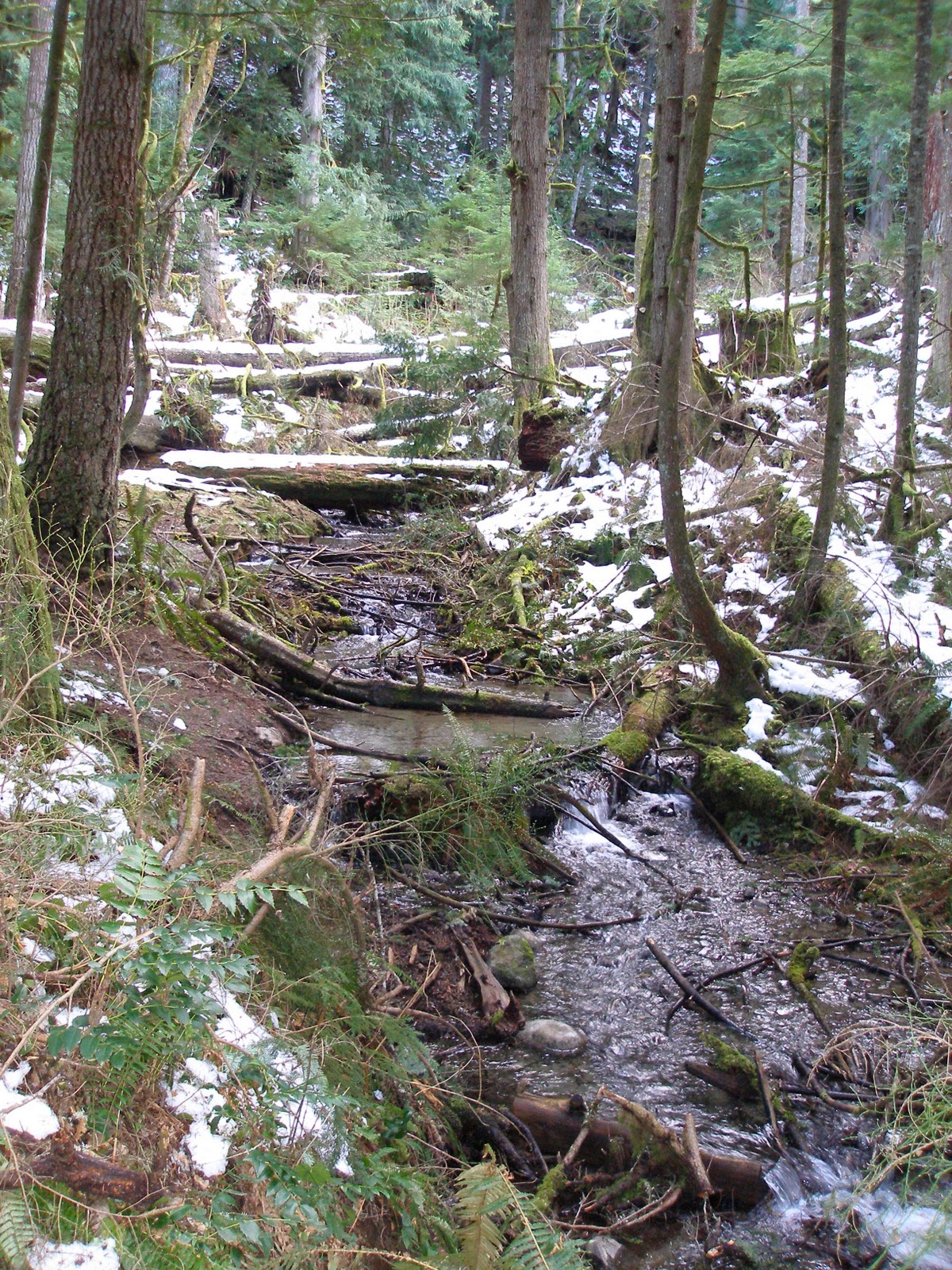
On I went.  For a brief few moments, the muddy trail wended through the trees, passing this stream.
Then it just went up.  Up, up, up and forget about leveling off at all.  I took my time, since I knew this would be pushing my limits and was a trail I was unprepared for, but still it kicked my butt.  Now and then for maybe 1 or 2 steps the trail would be flat and it was an amazing pleasure even for those brief seconds.  Then up again, through a sunlit forest of young trees.

A little hard-packed ice and snow started showing up on the trail as we climbed, and then less and less earth could be seen. Tree roots that twisted across the path were now ice-covered,
both tripping and slipping hazards. 
 We started to see a few hikers on the trail with spiky things for their shoes, trekking poles, snowshoes and other snow hiking/climbing devices.  One even had an ice axe.  I thought maybe that was overkill, but considering I didn't even make it to the top, maybe not!   
I kept hoping my legs would hold out and pushed on and on.  Finally, we got near where other hikers said the trees opened up on a scree slope.  It was gorgeous, and I noticed that we seemed to be actually above the elevation of some of the surrounding peaks.
I could tell that I would have to turn around here.  With the drifts and snow-covered objects, the snow was sometimes over Cedar's head.  He acted like the whole thing was a total lark, running and flipping tiny fir cones around, kicking chunks of ice down the slope (they fell for a long, long ways... it was steep!!) 
I checked his paws and gave him a lot of water, and he seemed to be thoroughly enjoying himself and none-the-worse for the wear, despite being snarled at and attacked by an off-leash dog a little earlier.  To be fair, she was old and crotchety and he was trying to play with her, but her people were not even in view yet and she could have moved away.  Her attack escalated fast, and I delivered a couple solid kicks and yelled at her.  Her owners apologized and let me know that "she wasn't socialized."  Ya think?? 
We sat for lunch on a log that I kicked most of the snow off of.  The remaining snow melted in through my layers and completely froze my ass.  The minute I stopped moving I remembered that I wasn't in a sauna (it was hot work, climbing) and the wind was brutally cold.  I made sure Cedar got some food to replace the calories he was burning, ate just half my lunch and threw my pack on again.
Down we went.  It had taken about 2 hrs and 45 minutes to get as far up as we did.  Another climber that had done the trail many times said I'd attained about 2/3 of it.  I will be back for the rest! 
It only took 1 hr 45 min to get down, but it was gruelling on my already-tired legs, and with no other equipment to help, I had to use my own balance to keep from slipping and falling all the way back.  Cedar pulled too much so I took him off his leash for my safety.
We made it back to the car and I felt a sense of accomplishment, despite not reaching the peak summit.  I will definitely be back, especially after reading more about the trail. 
It is an excellent training trail for my Rainier climb. 
After reaching the car, the little dog that had run all the way and acted like it was nothing, curled up on the fleece blanket on the seat and didn't move for the entire drive home.  : )  I guess it is possible to tire him out.


Sunday, November 28, 2010

Ebey's Landing - Whidbey Island

What a perfect hike for the winter.  When there is snow up in the hills, turn to the islands.  It was sprinkling as I headed out with Cedar and a friend of mine to the Mukilteo/Clinton Ferry, but close to Clinton he spotted some dolphins to starboard and that was pretty cool.  I hadn't seen harbor porpoises in a long time, and even a glimpse of their backs and dorsals coming up through the water was a real treat.
This 5+ mile hike started out at the Ebey's Landing area, specifically Prairie Overlook, next to a lovely cemetary.  I didn't think people would want Cedar watering their loved ones' headstones, or I might have been tempted to wander through and look at some of the inscriptions.  As I pulled into the parking area, a beautiful male pheasant walked in front of the car and then flew over a nearby fence.  Prairie Overlook looked over some lovely old farmhouses and a patchwork of farmland.
From there the trail went down to a gravel road and then out to the bluff.  The sun came out then and lit up the water, which was pretty calm.  Seabirds and kelp dotted the surface.  The trail followed along the top of the bluff next to the edge of a forest of windswept gnarled firs about 250-300 feet above the beach for about 2 miles.
The sun was quite warm and the view was just non-stop gorgeous.


A lot of cargo ships were going in and out of the Sound and I also spotted the Victoria Clipper.
Just as we began to descend, we saw a hawk sitting in one of the trees on the bluff.
We ate lunch on the driftwood logs, and then headed back toward Ebey's Landing, a 2 mile beach walk.  It was lovely, and a breeze was blowing that felt great after walking all that way.  There are some agates on that beach, but very few shells.

Another odd thing was that in many places bull kelp had apparently been buried upside down, so just the roots were sticking straight up out of the sand. 
The tide was pretty high, so I couldn't tell if it would be a good tidepooling beach.  Cedar found a dead gumboot chiton though (which he rolled on) and I found a dead jellyfish (which I did not roll on).
We also saw a submarine with a Coast Guard guard. 
Once back to Ebey's landing, it was steps back up to the prairie farmland, and across to the car.  Walking so far through the sand was a great workout.  My car felt very far away as we went that last stretch.  Cedar was apparently still feeling frisky though, because he pounced into the grass and caught a vole!  I should have taken a picture of it to prove I have a hunting dog now.
 This is definitely a hike I'll come back to!