Apple Watch stats: 7.39 miles RT, 2903 ft of elevation gain. The actual trail is likely just a touch over 7, but I did a tiny bit of backtracking when I hiked past a turn.

This trail starts out meandering through some lovely woods to Independence Lake at about 3/4 mile in. This is by far the most popular destination on this trail, and I had hiked this a couple weeks previously with Dave and the adventure dogs. Today though, with the rain, there was only one car at the trailhead and I met a man and his two small children hiking out from where they had camped overnight at Independence - and no one else. The rest of my hike I had the wilderness in all its gloriousness all to myself! Muahahahaha!!! ALL MINE!


Water streamed off of every surface - every fir needle, every leaf, every stone dripped and rushed and flowed with it. The trail was mostly a stream itself and I often found myself hiking up and down small temporary waterfalls.


The actual waterfalls along the trail were amazing. They roared and frothed and really celebrated the start of a wet northwest fall.


Around 2 - 2 1/2 miles in there is a left you need to take. It goes up a rocky slope that doesn't look anything like a trail. If you go straight though, the trail is super clear. This leads to what I'm guessing is the 2nd most popular destination along this trail - a lovely deep tarn. The trail comes out on the rocky banks of it and it looks like a great place to picnic or swim on a warmer day. I had recently taken a map reading class, so I not only brought my map - I actually looked at it for a change! I could see that I should not be right at the edge of this tarn, but up the slope a ways cutting upward. I remembered seeing a cairn back by the non-traily looking rocky slope, so I backtracked to there and from that direction the trail was a bit clearer. It's rarely easy to find a trail on rock though, and the rain covering everything made it harder to discern.
 |
| On the rocky shore of a pretty lake I wasn't supposed to end up on the edge of |
Up the slope above North Lake, it again got pretty rocky and the trail was difficult to follow. In addition, I don't think this section of the trail gets used as much so it was really overgrown.
 |
| Overgrown trail |

North Lake itself was beautiful. The far side was a slope with trees, but the trail meets up with the lake in a jumble of huge gorgeous boulders and to my left there were sheer granite slabs, shining in the rain. I ate a quick lunch using a boulder as a wind block and then headed back up that hill.


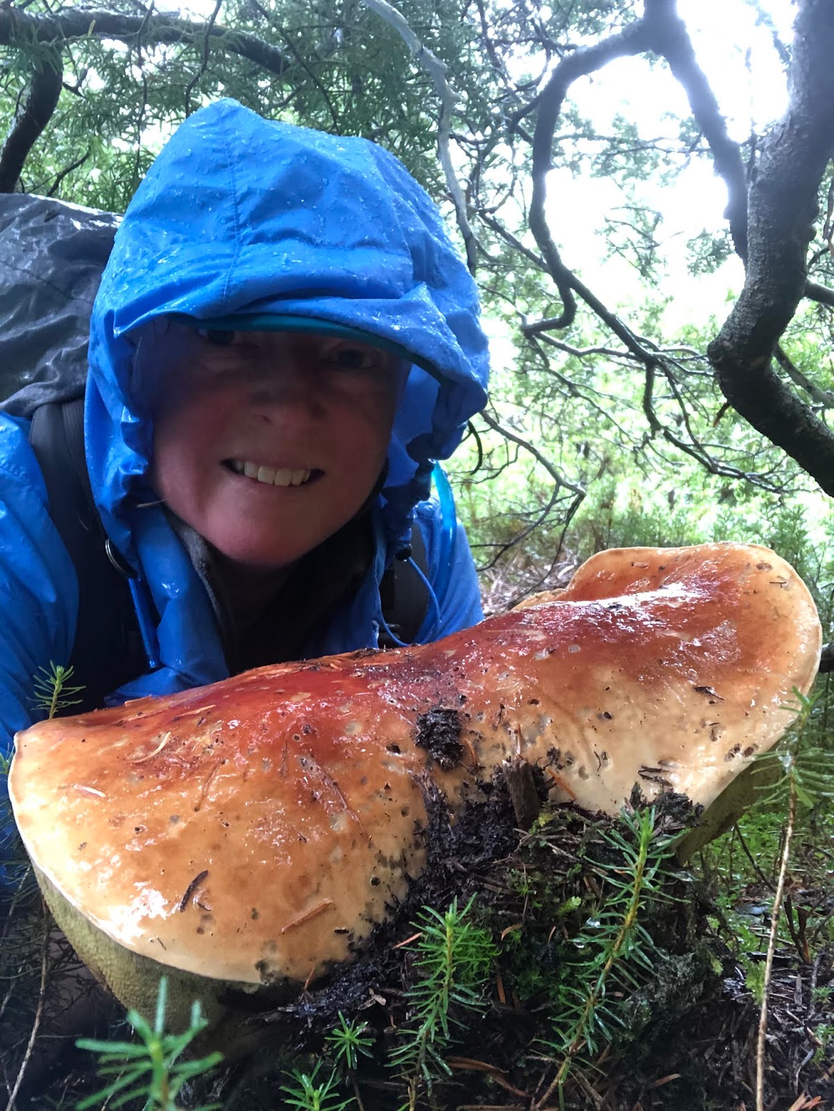
There were mushrooms everywhere from a wet summer and the fresh rain.


One big bolete was bigger than my head, so I scuttled under the brush to get a picture next to it for size (since I didn't want to pick it for no reason).
Another mushroom had been apparently growing next to a small stream, and the rainwater had flooded it.

There were quite a few bears head fungi which is a choice edible. I took a larger but less pretty one home and added it to a nice seafood chowder later. Yum!

Don't wait for good weather - get out there and adventure!
