Good thing to note - if you use the parking lot, the fee is $5. I thought it was $5 a car, but it may be $5 a person. It was just me and the pups, so it wasn't too bad, but plan ahead if you're going with a group. The falls afterward, I was told I didn't have to pay separately for, but the sign there definitely said $5 each. This is private property (the parking lot and the old resort), and an attendant is often there.
First, Cedar. Luna and I went up the hill and to the left to the mine shaft and cemetery. With a lot of chatter on the trail and some people shooting continuously in the distance it was not the peace I had been hoping for. I did see a red-breasted sapsucker though, calling out from the top of a snag.
There were people all around the mine shaft, so we went toward the cemetery first. The frame that held the water line is still standing, and there is rusted old metal and some foundations along the way.
On a clear day you can see Mt Rainier from this trail, but today's clouds just gave us peekaboo views of the frosty-topped hillsides.
We ended up getting to walk around the old cemetery in between groups of people, so other than the gunshots, it was quiet. The daffodils nodded in the ivy around the gravestones. Some yellow blooms had been picked and set on the gravestones.
Not only daffodils were blooming, but these creeping white and blue flowers, as well as wild currants. I saw the bleeding hearts were just starting to put out a couple buds as well.
When we got back to the mine shaft, that also was clear of other visitors. The sign says it is 1300 feet deep, but that is hard to imagine. I believe I read somewhere that it goes straight from the top of that hillside to a level 500 feet below sea level. Now that I can visualize with awe, as I stand on a hilltop and think about how far above the beach I am, and how far that means this dark hole is. I know that horizontal shafts go out from it down there in the deep, on many levels. 37 people lost their lives in the fire in 1894 at this mine. I read that several mules did as well. It is hard to picture mule teams down there in the darkness.
I don't always walk over to where I think the town (possibly?) might have been, but we did this time. I met a nice family and visited with them a little about the history I had learned about the mine. I really wish this hike had a couple information boards. The story of the people who lived, worked, and died here really bring history to life. One little boy was calling the foundations the "exhibits" and exclaimed that they were in a museum. His mom disagreed, but I told her actually he was kind of spot on with that impression.
 |
| Cedar and Luna posing (against their will) with an old mine car. |
When I got back down to head to the car, the attendant asked if I'd gone to the falls yet. I hadn't, as I remembered a steep trail near that parking lot. He told me to walk across the bridge and go through a gate at the Green River Gorge Resort and there would be steps. I am so glad I did!!
 |
| The falls from far above |
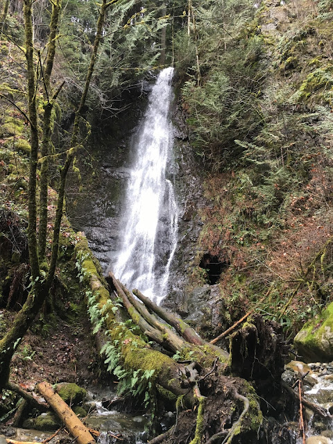
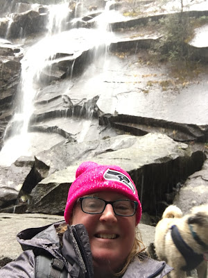
Winding down under the old one-lane bridge it was beautiful. There were numerous streams and rivulets flowing and cascading into the Green River. Mossy rocks carved over more time than I can imagine were carved out in bowls and curves. There was even a little grotto behind the falls. I read when I got home that although the waterfall is known now as Green River Gorge Falls, the historic name was Maid of the Mist. I'm not sure if that refers to all the various falls, or just the biggest one? Or possibly the little high up wispy one.
We really enjoyed it, and all those steps back up were a great workout! Get out and explore!


